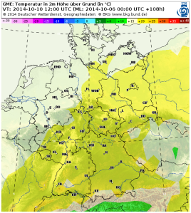
…seems (at least) the first decade of October will be warm and dry in Germany.


Edit (13 Oct 2014): Current NWP shows the formation of a high pressure ridge over Germany by the end of this week (with surface temperatures above 20 degrees centigrade). This development is seen quite consistently by all major NWP systems. Therefore, the month of October 2014 has potential to be recognized as one of the warmest Octobers. Time will tell…
Edit (20 Oct 2014): Models were right… It was extraordinary warm in central Europe (http://www.wettergefahren-fruehwarnung.de/Artikel/20141005.html). In the next days, cyclone NOA will lead to rainfall and dropping temperatures. But there is chance that by the end of this week, again a high pressure ridge bulbs out and channels warm (and dry) air from southwest to central Europe. However, this development is quite hard to predict since such a condition is very sensitive on the the evoked wind direction and thus the location and intensity of the atmospheric pressure systems.
